Tidbits of Shelby County History
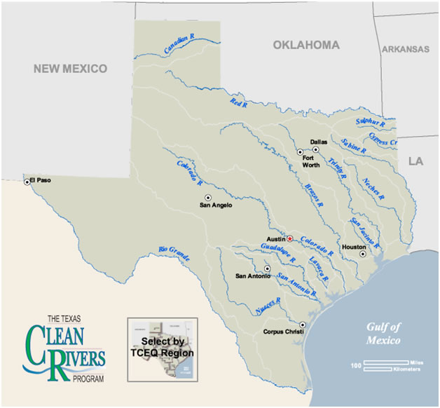
Sabine River
The information for this article was taken from an undated newspaper article. Rivers paid an important part in the development of the history of Texas.
At thethirty-second parallel in the southeastern corner of Panola County, the Sabine River becomes the state boundary between Texas andLouisiana, and thus the eastern boundary of Shelby, Sabine, Newton, Orange, and Jefferson counties. The river empties intoSabine Lake (at 29°59' N, 93°47 W), which is formed by the confluence of the Neches and the Sabine rivers; the lake isdrained by Sabine Pass into the Gulf of Mexico.The Sabine River rises in three main branches-the Cowleech Fork (rises in northwestern Hunt County and flows southeast for 49.2 mile), the Caddo Fork (shown as "Caddo Creek" on federal maps, rises in two tributary forks, the East Caddo Fork and the West Caddo Fork, in northwestern Hunt County), and the South Fork (rises in the southwestern corner of Hunt County and flows east for 28.3 miles joining the Caddo Fork and Cowleech Fork in southeastern Hunt County).After crossing most of Gregg County, the river forms portions of the county lines between Gregg andHarrison, Harrison and Rusk, and Harrison and Panola counties before it bends more sharply across Panola County.
The Sabine flows for 555 miles. Its total drainage basin area is 9,756 square miles, of which 7,426 is in Texas and theremainder in Louisiana. Unlike most Texas Rivers, the Sabine is entirely in an area of abundant rainfall. Average annualprecipitation is between thirty-seven inches at its source and fifty inches at its mouth. Also, it flows through forested sandycountry adaptable to the conservation of runoff and is fed by many flowing tributaries and springs. It has, therefore, aremarkably strong flow for its length, and it discharges the largest volume of water at its mouth of all Texas Rivers. Averagerunoff within 97 percent of the Sabine River basin during the 1941-67 periods was about 640 acre-feet per square mile. Twolarge reservoirs have been constructed on the Sabine: Lake Tawakoni, at the junction of the South and Cowleech forks, now inHunt, Rains, and Van Zandt counties; and Toledo Bend Reservoir, on the east and Louisiana border. The Sabine River basinis characterized by flat slopes and wide, timbered floodplains. High rainfall rates produce frequent flooding oflow-lying areas,and large floods occur, on the average, every five years. Floods generally rise and fall slowly, although flash floodsoccasionally occur in the basin. During flood the lowest part of the basin usually remains inundated for many days, andsometimes for several weeks. The extreme southern portion of the river is subject to hurricane flooding.
The Sabine River was too deep to ford and proved to be navigable. Early travelers and settlers would have to swim the river on horseback and cattle would have to be driven into the river to swim across. Ferries were later put into service. By the 1840s, steamboats were travelling from Logansport to Sabine Lake.Recorded ferry use began 1794, when Louis Chabinan (Sharben), his wife Margarite LaFleur, and their four children settled on the east bank of the Sabine River on land purchased from Vicinte Michele. In 1796, Chabinan was drowned after being kicked by a horse and falling into the Sabine. Michel Crow married his widow and ran the ferry, until he sold it to James Gaines circa 1819; it was renamed Gaines Ferry. This ferry was in service until 1937, when it was replaced by the Pendleton Bridge, built during the Great Depression.
The Sabine River basin has long been the site of human habitation. Archeological excavations have discovered evidence of allstages of southeastern Indian development, beginning with the 12,000-year-old Clovis culture. Indian development reached itspeak after the arrival of the Caddo about AD 780. The early Caddoan Period, which lasted until about 1260, saw theconstruction of large mounds, the southwestern most example of the Mississippian mound-building culture. In the Late CaddoPeriod, many of the mound sites were abandoned, but numerous sites show a continuing Caddoan presence in the area until the beginning of the historical era.
When the first Europeans entered the area in the sixteenth century, they found various groups of Caddo living along the stream. The name Sabine (Río de Sabinas) comes from the Spanish word for cypress and refers to the great growth of cypresstrees along the lower river. The stream was evidently named by Domingo Ramón in 1716, for it was designated Río deSabinas on a map of 1721 giving the route of the expedition led by the Marqués de Aguayo. The Spanish considered territorywest of the Sabine, and some territory to the east, to be part of the Spanish province of Texas. After the acquisition ofLouisiana by Spain, Spanish officials debated about whether the Sabine should form the eastern boundary of Texas. Thecapital of the province of Texas, however, was Los Adaes, on the east side of the river near the present site of Robeline,Louisiana. French traders operated along the Sabine, and both nations claimed the area. An examination of old Spanish mapsshows that up to the end of the eighteenth century little was known about the topography of East Texas. Some Spanish mapslabeled the Sabine Río de los Adais (Adas, Adiais, or Adays); others, failing to show Sabine Lake, pictured both the Sabineand the Neches flowing directly and independently into the Gulf of Mexico, or depicted the two rivers joining to form oneriver before entering the Gulf; yet other maps showed only one river. Some mapmakers referred to the Sabine as the RíoMexicano; others used this designation for the Neches.
After the Louisiana Purchase by the United States in 1803, a dispute over the boundary between the U.S. and Spain led to a demilitarized zone agreement on November 6, 1806, negotiated by Gen. James Wilkinson and Lt. Col. Simón de Herrera, to establish a neutral territory on both sides of the river. Neither country would put military troops or civil police there, which extendedfrom the Arroyo Hondo on the east to the Sabine on the west. The Adams-Onís Treaty (1819) established the western boundaryof Louisiana and the eastern boundary of Texas as beginning at the Gulf and extending up the Sabine to the thirty-secondparallel. Spanish delay in ratification of the treaty and Mexican independence (1821) put the boundary again in controversy.The United States for a time claimed that the names of the Neches and Sabine rivers had been reversed but no definite settlement was made. On December 19, 1836, the Congress of the Republic of Texasset forth the northern and eastern boundaries of the republic as stipulated in the Adams-Onis Treaty, and the United Statesdropped the claim to the area between the Sabine and the Neches. Despite the attempts of the Spanish to colonize the area,large numbers of Europeans did not enter the Sabine basin until the 1820s, when Americans from the southern United Statesbegan to settle there. When Mexican general Manuel de Mier y Terán was sent to the region in 1828 to report on conditions,he found that the ratio of Americans to Mexicans was nearly ten to one.
In the early days of the republic the Sabine furnished transportation facilities for lumber and cotton from Southeast Texas.Great logs cut from the pine forest were lashed together to make rafts, which were then floated downstream. Although moredifficult to manipulate, flatboats loaded with cotton and other products were also transported. Once the boats reached SabineBay, their cargoes were loaded on larger ships for transport to New Orleans, Galveston, and other ports. The booming rivertrade on the Sabine and Neches contributed to the rise of Port Arthur and Orange. The first steamships began to ply the riverin the late 1840s. Noted riverboats that served the Neches-Sabine basin included the Neches Bell, Pearl Rivers, Florida, Laura,Star, Katy, Frankie, Extra, and Maude Howell.Although by the 1870s and 1880s, railroads had begun to replace steamboats asthe most important medium for transporting trade goods, the riverboats continued to navigate the waters of the Neches until1900. Several of the last of the large steamers, including the Neches Belle, the Extra, and the Maude Howell, sank on the riverbetween 1890 and 1900.
During the late nineteenth and early twentieth century’s the middle Sabine River basin was the site of intensive loggingoperations, and numerous sawmills were built along the banks of the river and its tributaries. Downstream, the irrigationprojects were built during the early 1900s. After the Spindletop oilfield boom of 1901, the Sabine basin also became the site oflarge-scale oil exploration. The growth of the oil industry led to the development of the Beaumont-Port Arthur-Orangemetropolitan area as a major site for oil refining, processing, and shipping. This petroleum-producing region, and the lower river near the Gulf is among the most industrialized areas of the southeastern United States. The river was often described as the dividing line between the Old South and the New Southwest.As a consequence of these developments, the onceclean waters of the Sabine became increasingly polluted. Decaying vegetation produced natural pollution. Runoff from fieldsadded fertilizers, pesticides, and herbicides. Oil refineries and chemical plants discharged ammonia, phenol, sulfides,heavy metals such as zinc and lead, and other chemicals into the river. Straightening and deepening of the lower reaches ofthe river to improve navigation allowed salt water to back up into the estuary. Upstream diversions resulted in the lowerreach of the river being frequently composed of a large percentage of treated municipal and industrial effluent. In recent years,however, efforts have been made to clean up the stream. An areawide water-quality management plan was adopted for theBeaumont-Port Arthur-Orange metropolitan area. But in the early 1990s the pollution problem continued, especially in theriver's lower reaches. Management of the river and its watershed is overseen by the Sabine River Authority of Texas.In 1980 the population of the Sabine River basin was reported at 407,300. Longview is the largest city in the basin; other largecities include Marshall, Orange, and Greenville.